February 2011

So; Tom Wade and Wade's neighbor Kirk and I had a great tour this Saturday to Reynolds peak just west of dog lake. 

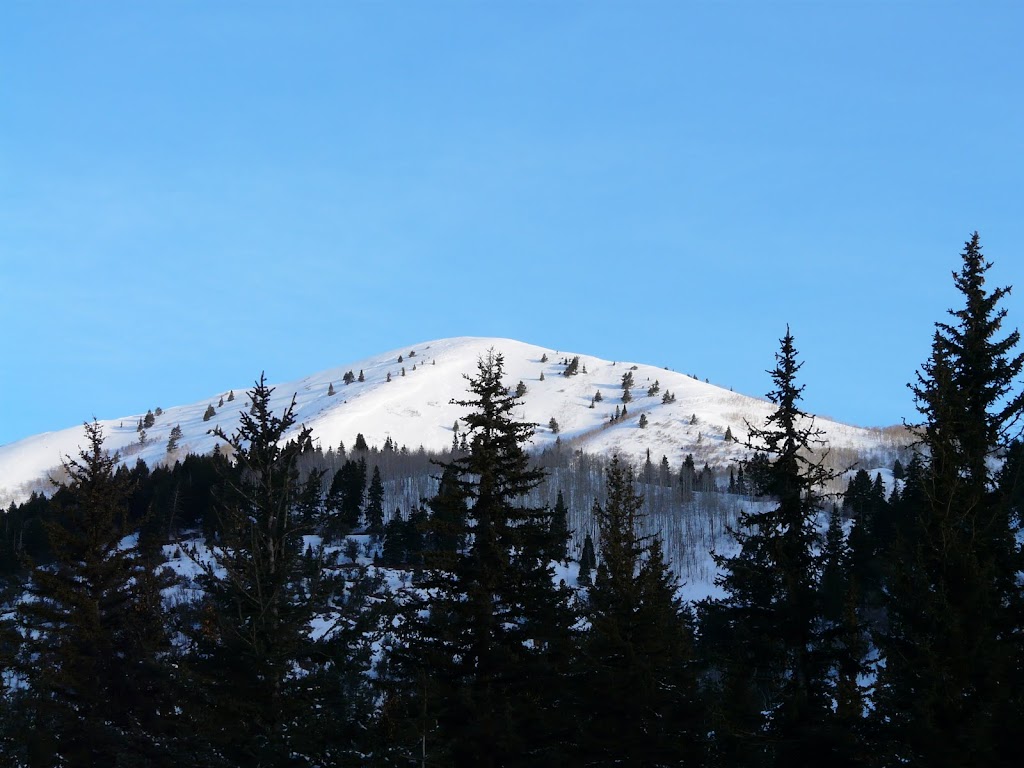
A view of Reynolds peak from the spruces parking lot

We met up at 7:45 and were on the trail-head at precisely 8:14 and a bit.  We started at the spruces because if you start on the East side of the canyon where the cabins are you gain elevation much more gradually.  We got up to the lake at about 11:00, where we met a dad and his kids out for a winter camp.  Cool.

Note to self.  Remember to take my kids winter camping (eventually)

After the easy peasy climb to dog lake (excepting that last half a mile push) we had a snack and hit the real climbing.   We opted for the direct route up the rise in the hill as opposed to going all the way around and climbing the ridge with its native rise.  It turned out to be a good choice...though it was a tough climb.  

Tom and friends (?) high on the ridge.
And looking ahead to the rest of the hike.  
Here is wade and tom, same angle, but with more perspective.


At the top we took a long break to take in the views.  Boy, what great views!  Here is lookind down canyon at (from left to right) Raymond and Goblers knob.  
  
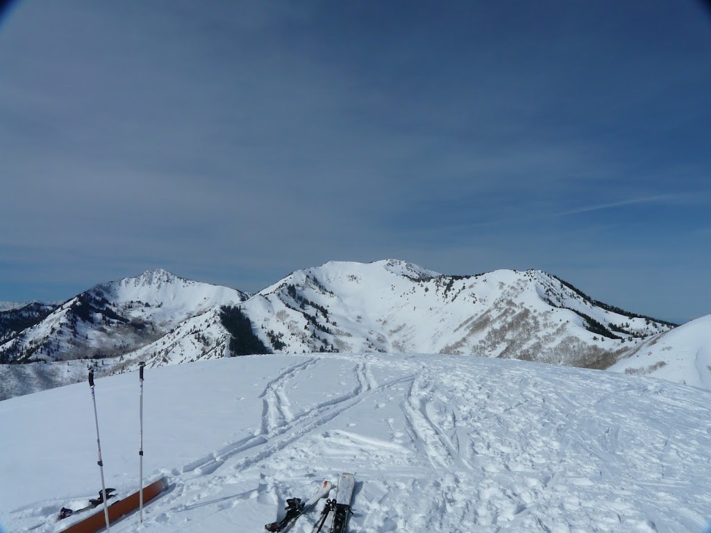
Raymond is a great hike, but to easterly for good snow most of the time

Skiing the North East face was much more pleasant in terms of snow quality that i had been expecting.  As you can see, it was pretty warm out there and i was worried that the face would have received too much sun to be any good.  I was wrong, it was great.  
Here is Wade showing off his bright new anti-camouflage.
And again on the lower slopes.  

Sorry to the other skiers, seems like the only non-blurry pictures were of wade.  probably because the camera auto-focus had no trouble tracking his jacket.

So i had my GPS running but it ran out of batteries or turned itself off about half way.  So my stats are from google earth and Kirks watch.  According the the watch we gained ~2100 feet in just under 3 miles going up.  

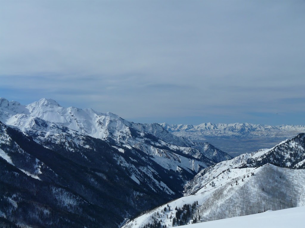
And it tooks us until 12:30 to get back to the car.  for a total tour time of about 4 hours and 15 minutes.  Of course, we spent at least half an hour on top admiring the beauty.  here is another shot to top it all off.

Yeah, it was a great day in the ol' Wasatch, but it almost always is.

*No video this week, my GoPro case broke on the pink pine outing and wasn't in the mood to lug the video camera and support up on this one.  I should have as it was a nice light hike....oh well.  Enjoy the pictures!

Reynolds peak wrap up

Posted on

Sunday, February 13, 2011

New video.  Better production values,  not as good of music?

New vid

Posted on

Tuesday, February 8, 2011

Wade and I had one of the few longer duration tours that we do this Saturday.  The plan was to head up to Whitepine lake and ski the West facing slopes but when we got up there, having talked to some people just getting off the hill, we changed our plan to the shaded East slopes on the ridge between White pine and Red pine, locally known as...yup...Pink pine.  Pink pine is usually the place to go if you don't have a lot of time, or a touring buddy because its safe, well traveled and short.  Wade and I decided we we ski lap it to make good on our promise of a good long tour.

We got started late because of high wind concerns and by the time we left the car it was past 11:00.  No matter, we had gained the ridge by 12:30. 

 (wade being "nonchalant" on pink pine ridge)

After we got to the top, We dug a pit to conduct a Rutschblock Test 
Here is wade doing some SCIENCE!

So we dug a pit and despite it not being deep or long enough, we went ahead with our tests
A Rutschbnlock test is about 2 things; 
Effort required to sheer
and
Sheer Quality.

Sheer quality is considered the more important of the two because it describes the likelihood of a triggering event moving the slab and its intensity.  The Effort required to sheer is indicative of the amount of force it is likely to take to initiate a slide on the slab. 

Wade stepped on the slab to start us off
And After 7 hard jumps on the upper part of the block
We got a failure
The line you see in the first pictures is where just below the rime crust, where the block failed.  Just underneath the hard icey rain layer was a thick nest of facets that act like fragile little sissy's trying to carry a washing machine up a flight of stairs.  

The test results were RB7 - Green
Sheer Quality Q2 - Yellow

Based on this info and the other indicators we saw as we were hiking, it confirmed the avalanche report for the day which indicated L2 conditions on West facing loaded slopes.  We felt very confident that the likelihood of triggering a slide was remote.

So, after that we hiked up the hill higher and dropped in through some trees.  It was GREAT!
Here are a few stills taken from the video I am still working on.


So there you go...something to look forward too.  Also worth mentioning is that wade got a lot more workout than me due to a missing of the trail.  Looking at the video he was recording at the time and seeing the tracks im not surprised, as he is not the first one to do so.  Anyway, wade sent me a map of where he thinks he went [red] and where the trail was [blue]  It doesn't look too bad except that between those colors is about 200 feet of evelation and a river.  Also some boulders down lower.  All in all it was 60 extra minutes of superbowl prep that wade got and I didn't.  Moral of the story.  Bring the dang radios next time [me].  
Again.  Video coming soon.  My computer at home died and all i have is a MBP to complete it.  I don't know how you people even try to edit on those things...


There will be a tour this saturday morning leaving at 930.  Place TBD.  Estimated tour duration 4 to 5 hours.  Its going to be a good ones folks.  Call me. Email me. Or chat to let me know if you want in.

Tour

Posted on

Friday, February 4, 2011