2012


This Friday I took off work to ski with my brothers at the bird, it was great!  I wont bore you with details but the the snow (about 2-3 feet of it) was light, the sky turned blue and we skied until we blew up.  Ben almost literally when he nailed that rock at full clip.

Anyway, check out the video in the player above or on YouTube for HD and mobile HERE

Snowbird

Posted on

Sunday, December 30, 2012

 Emma Ridge, looking into Silver fork and Big Cottonwood canyon.

Normally I would just call it "Davenport" or "flagstaff ridge" but thanks map!  you've shown me the error of my ways!

Wade and I got to get out for the first real ski this year, last time was just too much snow and not enough slope.


We got started around 630, in the dark (and me without a headlamp) and decided that although the snow on the south facing emma ridge was going to be poor relative to other slopes, we wanted to start out on something safe and secure to build up avalanche confidence. 


 I've said it before and I'll say it again.  I LOVE watching the sun rise on the Wasatch!


 It took us about an hour and half to get to the top because of some slipper snow and step kick turns (check out the map)

and once at the tops we went left to get the snow that would, hopefully, be a little more wind sheltered...it wasn't.  On the plus side, it was vary variable so even though it was tough most of the time, it was creamy in a few places.


And most importantly, it was a blast.


Check out this cool jump wade...


...oh I guess you saw it.  Bye wade.

There will be a video on YouTube soon.  I will link to it hereIn the mean time, check out the mytracks.


View Davenport 122112 in a larger map

Emma #4

Posted on

Friday, December 21, 2012

Stupid title for a stupid post.  This is just an invite to all members of the URC who are on google+ to check out the community I created to do multi-way chats, hangouts and announcements easier.  


The URC has gone social

Posted on

Sunday, December 9, 2012

Every now and again, cool stuff falls into my lap that changes things a little, the Skidmap project was one of those and now, in that vein, wasatchbackcountryskiing.com.  I haven't had a chance to really explore it as of yet, but it appears to be a complete listing of every known major route in the wasatach AND know avalanche fatality spots.  Pretty solid.  It will be added to the link list so check it out. 

Wasatch ski map

Posted on

Monday, November 26, 2012


First off, let me hit the highlights:

24 inches in 24 hours
48 base
15% to 8% to 3% density

Thats according to alta.com

What we actually measured was 140 cm to the old snow...on saturday before the storm finished.

140 cm is over 4 and half feet!  55 inches!


And still coming!

Okay so the plan was to do gunsight, like I have done in the past with both great success and great failure.  Its not a big tour, but its tradition.  Every year I've had a good gunsight tour, its been a good ski year, every year I didn't have a good tour, it wasn't great and last year I didn't get to go at all and we all know how that turned out.   Im not a superstitious type but this winter is pretty much down to me having a good season opener.

It didn't start well, Wade got to my place at 9 like we planned but the power just went out and so we had to run to get a generator for my dad who is on a by-pap.  After that we had to clear the driveway so he could get around, so we got a late start.  No biggie.  Wade also forgot his skins, which was very very bad until I remembered my spare set, cut for 169/80's and we put them on his 178/105's.  I was pretty worried about CSF  (congenital skin failure) as it has happened to people in my party more times than I care to count (turns out they killed it!)

So back to gunsight, we started hiking up, past the warning signs telling us not to go up until we were stopped by a patroler on a snow mobile telling us to pack it in or face a fine.  Normally I would blow it off but he said they would be bombing in that area that day (they didn't BTW).  So I didn't get to do gunsight, which was a bummer and we headed down to start up the summer road to try out toms ridge, since that was about all I could handle with my death cough that I had been dealing with.


It worked....sort of.  Turns out there IS too much of a good thing.  Because of the snow was so deep we couldn't break free and just plowed, chest deep, through it.  A steeper slope would have fixed it, but a steeper slow would be a no go because of the amount of snow.  Catch 22.


We still had a great time, as evidenced by Wade's smile, and even made some new friends.  Hey Chris!

All in all it was pretty good for a first outting, no one died or got injured, I got to try out my new custom fit boots

(thanks BTW to Inkline footscience and Chris for putting in the extra hours)


yeah.  It was so good even being stuck was a good time.

Check out the google map here

And download the earth file here

Sucessful season opener...a little too successful

Posted on

Sunday, November 11, 2012

Tomorrow morning, Alta...who wants in?

Season opener?

Posted on

Friday, November 9, 2012

Courtesy of Coby and his lunch break, check out the video in the player above, or here on YouTube in HD.

New video posted!

Posted on

Monday, October 15, 2012

In what might be one of the last rides of the year, Coby, Wade H. and myself did more of the mid mountain trail that I have ever done before, and might actually be the longest ride I have ridden to date.

take a look at the map.


View Mix Mountain To Red Pine Lodge in a larger map

and the stats


Of course, the elevation  has some blips in it, but its pretty telling, mostly in the fact that the last few miles were kind of a tease.

So, going back a little, let talk about how we ended up on mid mountain instead of the crest, which was the original plan.


Well, that about sums it up.  That's a pair of snowboards at the top of guardsman, yeah apparently is snowed enough to get the crazies out to build jumps.  I used to do that, but now I realize what a silly thing that was.

Anyway, so plan B, was to finish the drive down guardsmen pass into park city and start mid mountain from deer valley stein Erickson lodge.  I want to say, that driving gaurdsmen pass is amazing and I love it!  here is my drive coming from midway the day before.


yeah, what an amazing place we live in.

back to the story, as you can guess it was pretty cold (between 38-45 degrees) since it was snowing at 10,000, but moving down to 8000 and coming over into the park city side of the Wasatch made it bearable.


bundling up in knee/leg warmers and layers of clothing helped, and it was actually quite pleasant.

Now, the plan originally was to ride the crest to the milcreek pass and then ride into the canyons were a parked car was waiting where we would ride back up and get the car.  Since the change we brought the car to deer valley but the car was still waiting at the canyons which meant that we needed to either bomb down into park city via spiro like usual and ride all the way into town, or ride the additional distance to get to the car, we chose the latter.

I guess we didn't realize how long a ride that was going to be, it ended up being about 17 miles just to the red pine lodge at the canyons, and about another 4 miles down to the car.  because we were expecting a 13 mile ride and not a 21 mile ride, we didn't have the appropriate food to power us on, so by the time we got to red pine lodge, we were pretty spent.

Having to face the prospect of having to ride up and down and up another ridge as we were was unattractive.  Fortunately,  with a small amount of persuading including a playing of the "I don't want to get struck by lightning...again" card, she let us down the gondola on the "safety concern" provision.  Certainly not something anyone should count on, but we are very grateful for for exception on our behalf.

It sounds like we were in worse shape than we were and that this ride was a rough experience, but it really wasn't, it was amazing.   The trail was perfect, the scenery was amazing and the quite at times, was overwhelming.  The terrain change from resort to resort (deer valley, Park City, Canyons) was stark and very fun to see, Deer valley having the most even keel flow, Park City being a bit more exciting in elevation, but still silky smooth, and the canyons, a very different and very north shore like ride:  mossy rocks, challenging rocky riding and dense pine forests.  This is easily one of the best rides that exists, hands down.  The best part?  there is at least another 10 miles of it that we never got to!  So next year, it will be mine.


a view from deer valley.  Imagine all those yellow leaves on the trail, and riding though aspen groves at the same time...or wait for some of the footage from Coby's gopro [In player above or on YouTube HD]

even better?  Park city FINALLY has a few good cheap places to eat in the new mini mall near kimbal junction


Mid mountain to red pine lodge

Posted on

Sunday, October 14, 2012

Tom and I went out this Saturday to get a lay of the land, getting ready for this shoot.  For some people it works better Friday, some Saturday, Let me know what works best for you if you are coming and haven't told me already.  This short video should give you a taste of what the trail is like, and the lighting.  Its going to be very cool.  Also, tom and I had a great ride exploring the area more than we usually do, including a tour of the mystery building at the top of the trail.


  So check out the new video in the player above, or on YouTube in 1080p

Lcc Preview

Posted on

Monday, September 17, 2012

This is bike related, but only partly.  I am looking for people to help me with a personal project of mine, a short bike film. 

Here is the plan.  I want to film the "secret south" part of the upper Temple Quarry trail, for various reasons including; proximity to the road, low volume of traffic, very technical...but mail for this.


Its an amazingly place to be


With lots of really cool features


So I've been doing my homework and I have come up with a list of things I need, A few shots I want and how to get them, but I need your help.  Coby/Dustin, I need as many GoPro's as you can muster, Especially the Hero 2.  Beyond that I should have equipment very well covered but not enough man power to pull it off. 

I have talked to Dustin about being the star of the show and Im hoping that he will be able to, he is also helping where he can on some technical rigging gear. 

Wade, Tom L. (or Tom S.) or anyone else who would like, I could use some help with camera's, Rigging, and Audio. 

I have 4-5 positions:

DP - Director of Photography, that will be me.  Responsible for camera 1 and 2
B-unit Camera - Responsible for the second unit camera (3) and associated gear.
Audio/Cam3 - responsible for running camera 4 and capturing the audio, this would include boom mic holding and carting the gear around
Rigging - This person is responsible for helping move gear and rig really cool camera rigs that Dustin and I are working on.
Stage Manager - This person would help move gear and be responsible for helping make sure we aren't going to have safety issues with hikers or other riders, Also for using the radios to keep in touch.

As you could guess, Some of these positions could be merged or expanded as needed so the more help the better!

All Told, I should have something on the order of:

4 main cameras
4 GoPro's
audio gear
slider
line rig
ladder
2-3 tripods
Lenses
Misc rigging/Gaff gear

And as you can guess its way more work than I can manage on my own, but it should look amazing and be lots of fun!

I was thinking about Next Friday or Saturday evenings (21st or 22nd) from 500-900, that should give us enough time.

If it works for Dustin, I would like to go this Saturday evening as well to get the POV shots so they wont show in the wide shots. 

PLEASE email me if you would like to be involved, I think it will be a ton of fun.  Thanks.

Casting call

Posted on

Friday, September 14, 2012

So I didn't get an pictures, or not even a MyTracks, but Wade and I had a really great ride this last Saturday. 

Every time I ride the Quary trail I am reminded why I like it so much; I've never been the fastest climber, or the gustiest downhiller, but the ride I am today was molded on this trail and that is, technical.  I love technical riding!  Technical riding is the reason that slickrock, despite having ridden it 20 billion times, is still fun.  And its why this short little drop of a trail is so great.  It has at least 4-5 sections that are genuine technical hurdles, and not just for beginners or intermediates, there is some tough climbing AND descending on this trail.  Wade summed it up when he said that everything you need to learn about riding can be found on this trail. 

Its a mild uphill with a few strong pulls, it has technical uphills, tight descents with variable surface conditions and if you really want to get crazy, a little technical offshoot that has the slow speed curved and rock sections for some really great technical riding.  Add that in with the scenery, with the river and the granite boulders along the way and the fact that its close and short and...well it just has all the riding you need to get good and enjoy yourself doing it.

I think I am going to head out there again sometime this week or weekend, but armed with cameras and really capture, for the first time, the secret offshoot with technical sections.  If anyone is interesting in helping me out with a little film project and getting some good ridding in, please let me know. 

Temple Quary trail

Posted on

Monday, September 10, 2012

Wade and i are doing temple quarry ~5 today of anyone wants to ride

Ride

Posted on

Saturday, September 8, 2012


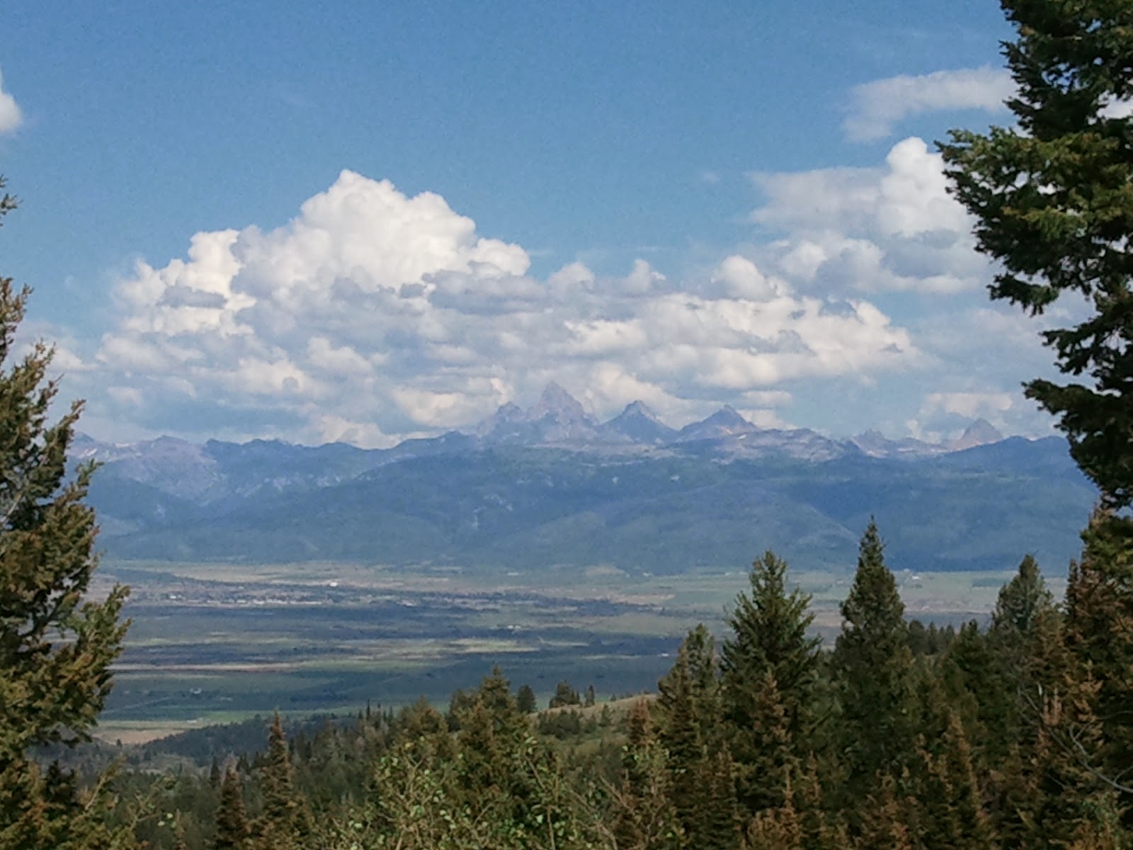
Check out the great smokey mountains...or at least the smoke choked Wasatch, a pretty and sad start to our crest trip.


I really needed a ride this Saturday, what with the Blur being so hot lately, and it turns out so did Dustin and wade.  We met at Einsteins bagels (more on that later) by milcreek and Bri would drive us up to gaurdsmans in Siddoways nice new truck.  This picture illistrates Dustin's vision (though he is looking the wrong way)

Speaking of Dustin, He and Wade have both been going on about this great new variation to the classic crest ride, where instead of heading down in the milcreek, you go down into the canyons resort.  Well, I figured if it was as good as they have been saying than they wouldn't mind doing it again so I could partake.  We got off from the parking lot around 1030, about an hour after we had planned because people were getting breakfast and because I forgot my shoes and helmet at the house and had to go back and get them.

We got on the trail around 1120 and immediately ran into a little bit of trouble.  It was literally like the 5th or 6th turn that, because of moon dust conditions and overconfidence, I hooked a tree on a side sloped left/right and speared off into the curve, and promptly hit a tree head on.  I heard a loud crack but wasn't too worried that I had pulled a Wade since it was a very low speed crash, in fact had the tree not been there i would have take another step or two and just stopped.  But all the same it was my helmet that made the crack and so I'm getting a new helmet.


Frankly, I'm a little glad I crashed.  I haven't had a significant crash in...honestly I can't remember, probably 10 years or more and I was beginning to worry that I was building up some type of "supercrash" that would land me in the hospital.  I don't know why I don't crash often, I just don't and its not a secret.  Bri asked Wade the other day i guess, why I never crash.  In fact, I have never crashed since I have known Wade.  Or Dustin for that matter.  But now, since I have i can rest a little easy knowing that I have vented some crash off and staved off a supercrash...or something like that.

Dusting off the crash I got right back on the horse and went full speed the rest of the ride, or as full speed as I could go, you see Dustin and I made a bit of an error in our breakfast choices.  Dustin ordered something called a Tuscan and I ordered a plain baggle.  Dustin described his bad choice as, "an explosion of cream cheese"  while I simply called mine a "boat anchor".  Turns out its hard to digest a huge wad of baggle and ride with a stomach full of cream cheese and Dustin and I both suffered greatly for it, Me for a general lack of energy, and Dustin with the "I just want to puke"s.  But we soldiered on.  If you look at the MyTracks, you can see we rested a lot.


View Crest To Robs in a larger map

Fortunatly, we made it to the the top of puke hill sans puke.  Dustin even rode the whole thing...well played old bean.


I walked some of it, because of the baggle bomb, add to that my brakes aren't working very well and that I had to use more fingers to brake and fewer to hold onto the bar, causing hand cramps and I was pretty well spent by the time we reached the spine.  I was planning on riding it, but given the situation (helmet, gut bombs, hand cramps) I elected to walk.  Dustin Nailed it though.


 And Wade hit most of it, having to stop and restart once.


When we reached the top of the trail, before heading down to park city, Dustin had a good forced puke and I was just starting to feel better, though my hands were getting to be toast.

I don't have any pictures of the decent in the canyons, but its beautiful.  We rode down and met up with robs trail and rode that to the bottom.  It wasn't as nice and smooth as Milcreek (more exposed sections) but it had its moments.

After we got down we rode from there to the strip mall near kimbal junction


View Road To Food in a larger map

IT was a fun downhill and if you check the stats, we got going pretty quick.

There we met up with bri and had a nice late lunch pizza


It was pretty good, but not as filling as the price and wait would have made me hope.

at the end of every crest ride I always forget how long the whole thing takes, from door to door it was 930-400.  of course, knock off about 2 hours without lunch or delays, that still makes it a full half day adventure.  Worth it, but maybe a little more worth it when we get a little rain.


Just a quick post to remind myself in a year, that riding is awesome.  I finished building my new wheels, and am now [finally] fully tubeless. 

The combination of the new fork with more travel and rake, and the higher volume, lower pressure tires conspire to make the blur the bike I always wanted it to be; plenty fast on the uphill, and what I would call "XC loose" or "trail tight" on the decent.  The original setup was just too twitchy on the decent for me and, frankly, wasn't a big enough difference between the S-works and the Blur to be able to ever choose between the two on a ride.  The S-works was like a track car on street legal tires, and the blur was like a sports car on racing tread, and I could never decide what was right for a given trail, the line was...blurred (sorry).  Now the blur has a nice "sports sedan" feel.  smooth, flowing, but forgiving and progressive.  in short...I'm loving it and choosing between the two is no longer a battle.  Fast and smooth (dog lake, slickrock, gooseberry mesa etc) S-works, flowing, variable or aggressive (the crest, rush, bobsled, etc) the blur.  Finally


I got to try it out on a morning ride with Wade, Petro and Coby at corner canyon yesterday (the 15th), heading up potato hill, up anns trail and down rush.  Going fast on the decent is about three things:  confidence in skill, bike/rider communication, circumstance (trail conditions, components, etc) and yesterday it was all clicking...well, with the exception that my brakes need to be bled BADLY.  I felt like at 8/10th I was going faster and easier than my normal 9 or 10/10th.  It was great, and it was fast.

So, although I don't have pictures or video of the ride (how many times do you need to see rush in video anyway) I want to remember this if I look back on this blog a year from now or in the winter and remember how awesome riding is.  I love it when a plan comes together.


View Anns To Rush 81512 in a larger map

Rush 8-15-12

Posted on

Thursday, August 16, 2012

Just checking to to report on the condition of the Rush and Clarks trails.  Both are in good, by dry condition.  I came closer to eating it this morning than I have previously on other trips, but all in all.  It was nice. 

Here are the stats.


View Clarks To Rush in a larger map

Rush

Posted on

Friday, August 3, 2012

Last Saturday Anna and I went on a short easy ride in park city, recommended to us by our local hero Bobby P., called "Rambler".  Its over on the far side of town on a little hit and was part of a network of short, easy trails in the area.  Getting most girls, and specifically, our wives to go on a ride with us is a bit of a catch 22: its great to do what we love to do with them, but it can backfire in a big way if your not careful...with ANY beginners for that matter.  So with that in mind it is of critical importance to choose rides that are easy enough to not discourage and frustrate both technically and physically, but are also engaging enough to peak interest.

Im please to report that this area is mostly that.

Here is the area we rode


And our map


View Rambler in a larger map


The loop we did started at the Ice rink parking lot and went out north along 40, up a slight slope with some very mild rocky sections and switchbacks.  From there you turn west and head up hill to the top of the knoll.


Here we decided to turn off rambler and head down Elk Nowhere to Elk Somewhere.  Both of which are relatively mild downhills with the occasional steep sections.  BE AWARE:  this trail is littered with crizzards and other bugs with eyes the size of Wisconsin, or so says Anna.  Crizzards, by the way, are some type of cricket lizard hybrid that can melt your face.  They look and act a lot like grasshoppers but don't be fool, if a crizzard got the chance it would melt you and everyone you care about!

Despite the deadly deadly bug problem, it was a very nice ride, with some great views.  Just check this out, where else can you see 3 different ski resort in one glance?


More info on the trails can be found here or on the trail map link on the sidebar.

Its a great place to go riding singletrack that wont ruin your marriage or friendship, what more could you ask for?

Short deer valley ride

Posted on

Thursday, August 2, 2012

anyone looking for a good 4 bike rack for 1 1/4 or 2 inch receiver should check out steepandcheap.com from now (930 am) to 950.  or if you missed it 40% off, don't worry, its only $20 more on backcountry

http://www.backcountry.com/yakima-kingpin-4-hitch-bike-rack?rr=t&cmp_id=ODAT_RR2001&rrType=ViewedPurchasedPercent&rrProd=YAK0317

This is Wade writing this post so there's not any confusion. So anyways my older brother lives in China and he was in Mud Lake, Idaho at my parents house. When all of our family gets together we do a lot of sitting around so my little brother, Tom Siddoway, and I decided in advance to bring up our bikes. Since we didn't get into mountain biking until we moved to Utah, we had no idea where to go because it seems like nobody in Southeast Idaho mountain bikes.

So we had to do some research and after what had seemed like a good day until we found a place that was all single track. We found this website that had trails for the Teton Valley-Teton Valley Bike trails.I grew up coming to these mountains every summer because this is where my dad's sheep range was and in my opinion this is the prettiest mountain country you will find anywhere in the world.

 We decided to do Horseshoe canyon. It was closest and there are many trails to chose from. So after getting up there and assessing the terrain and weather, we decide to do the out n' back Horseshoe Creek South Fork because it was starting to get hot and it provided lots of shade because of the thick pine trees. 

Probably not the best idea to ride the shady stuff 2 days after a heavy rain storm. Lets say we got pretty muddy in some spots but was some friggn' awesome singletrack. The trail was well maintained (It would have been even more pleasant if it was dry!). Second provided a good workout because of the good steady climb some technical sections with big thick tree roots. Downhill was even better, wide radius banked switch backs allowed you to keep up your speed. The trail is in a canyon most of the way but opens to some sweet views near the top.


View Horseshoe Creek South Fork in a larger map
Total distance: 14.76 km (9.2 mi)
Total time: 2:18:31
Moving time: 1:17:32
Average speed: 6.39 km/h (4.0 mi/h)
Average moving speed: 11.42 km/h (7.1 mi/h)
Max speed: 35.64 km/h (22.1 mi/h)
Average pace: 9.38 min/km (15.1 min/mi)
Average moving pace: 5.25 min/km (8.5 min/mi)
Min pace: 1.68 min/km (2.7 min/mi)
Max elevation: 2392 m (7849 ft)
Min elevation: 1957 m (6420 ft)
Elevation gain: 591 m (1940 ft)
Max grade: 4 %
Min grade: -18 %
Recorded: 07/17/2012 2:15 PM
Activity type: mountain biking

Horseshoe Canyon, Idaho

Posted on

Thursday, July 19, 2012