July 2012

This is Wade writing this post so there's not any confusion. So anyways my older brother lives in China and he was in Mud Lake, Idaho at my parents house. When all of our family gets together we do a lot of sitting around so my little brother, Tom Siddoway, and I decided in advance to bring up our bikes. Since we didn't get into mountain biking until we moved to Utah, we had no idea where to go because it seems like nobody in Southeast Idaho mountain bikes.

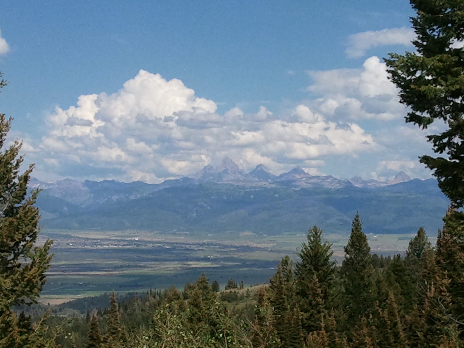
So we had to do some research and after what had seemed like a good day until we found a place that was all single track. We found this website that had trails for the Teton Valley-Teton Valley Bike trails.I grew up coming to these mountains every summer because this is where my dad's sheep range was and in my opinion this is the prettiest mountain country you will find anywhere in the world.

 We decided to do Horseshoe canyon. It was closest and there are many trails to chose from. So after getting up there and assessing the terrain and weather, we decide to do the out n' back Horseshoe Creek South Fork because it was starting to get hot and it provided lots of shade because of the thick pine trees. 

Probably not the best idea to ride the shady stuff 2 days after a heavy rain storm. Lets say we got pretty muddy in some spots but was some friggn' awesome singletrack. The trail was well maintained (It would have been even more pleasant if it was dry!). Second provided a good workout because of the good steady climb some technical sections with big thick tree roots. Downhill was even better, wide radius banked switch backs allowed you to keep up your speed. The trail is in a canyon most of the way but opens to some sweet views near the top.


View Horseshoe Creek South Fork in a larger map
Total distance: 14.76 km (9.2 mi)
Total time: 2:18:31
Moving time: 1:17:32
Average speed: 6.39 km/h (4.0 mi/h)
Average moving speed: 11.42 km/h (7.1 mi/h)
Max speed: 35.64 km/h (22.1 mi/h)
Average pace: 9.38 min/km (15.1 min/mi)
Average moving pace: 5.25 min/km (8.5 min/mi)
Min pace: 1.68 min/km (2.7 min/mi)
Max elevation: 2392 m (7849 ft)
Min elevation: 1957 m (6420 ft)
Elevation gain: 591 m (1940 ft)
Max grade: 4 %
Min grade: -18 %
Recorded: 07/17/2012 2:15 PM
Activity type: mountain biking

Horseshoe Canyon, Idaho

Posted on

Thursday, July 19, 2012

Tom and I had a great ride up temple Quarry yesterday.  It remember why I like this trail, despite not having ridden it in some time...its a load of fun.  I cut my mountain biking teeth on this trail as a teen and I did it on, essentially, the same bike I was out there on yesterday.  I bought my s-works back in 1999 and, although every single part on it is new to date, it rides about the same as it did back then.  Riding this trail, that despite going through as many ecological changes as my bike has parts, is roughly the same was illuminating.

Without going into too much detail, this trail is still one of my favorites and Im glad I rediscovered it.  Check out the trail map here (we didn't make it to the top because of time constraints) and click here for the HD video or above in the player for SD

Temple Quarry

Posted on

Sunday, July 8, 2012

I have posted about the Wasatch Crest a number of time on this site, and I wont go into great detail on the ride here as far as the specific trail details.  What I will relate, once again, is how awesome this trail is.


Let me start by saying that despite the trail parking lots being absolutely mobbed, the trail is big enough to accommodate a large number of riders and we were never held up too long; by riders other than us, that is. 

Okay, so I will expound a little on the trail via the My Tracks map


View Crest in a larger map

Click here if you are interesting in the telemetrics of the decent down the, mostly, deserted Millcreek canyon road.

So let me expound the highlights

No bones were broken
No bikes were broken
No tubes were changed
Only 1 person barfed at the top of puke hill

All in All a resounding success.

Also, in case you're wondering why puke hill is so bad?   500 vertical feet in half a mile, yeah its pretty much strait up a mountain side.  Click on the end point on the map to display the graph and take a look at the first big hill you see.  Yeah.

As for failures?  Well, that was mostly in my court.  I really have a conflict between wanting to be present for the ride, and stopping to get good footage.  The GoPro has been great for cataloging the ride without user operation, but on the flipside, its really only a tool to get cutaway shots or "holy crap you have to be kidding me" shots.  Since we don't get the later, we are stuck with a lot of the former.

As an editor, there is only so much I can do with that type of footage.  The GH2 takes great "A" material and when I take the time to get it out it really makes the action pop...but I have a hard time doing it since it takes time, and then everyone rides in front of me.  I need to either be a much faster or much slower rider to take more "A" material footage.

The other problem is that...well, despite my best intentions I often totally screw up.  My plan was to get as many cameras as I could (up to 5) and get multi-angle goodness.  It ended up being a disaster of 2 cameras of which only one angle was any good, and because I put the wrong SD card in one and it ran out, I assumed the other camera had run out too and I put it away (filming the whole while in my bag) down the prettiest and most enjoyable part of the ride.  So...Sorry for the video thats not so great.

As least it snapped a few good pictures


The Youtube video is available below, or the sd version above in the player


June 2012 Crest

Posted on

Monday, July 2, 2012